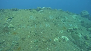
Heian Maru Wreck
| Field | Value |
|---|---|
| Wreck Category | wreck showing any portion of hull or superstructure |
|
Heian maru Wreck Location Marine Coordinates (DMM) |
7 23.033 N,151 51.683 E |
| Latitude, Longitude Decimal Degrees |
|
| Water Depth | 0 m |
| Vertical Datum | Approximate Lowest Astronomical Tide |
| Name | HEIAN MARU |
| Type | tender |
| Flag | JP |
| Length | 155.8 m |
| Width | 20.1 m |
| Draught | 12.5 |
| Tonnage | 11616 |
| Tonnage Type | gross |
| Conspic Visual | not visually conspicuous |
| Conspic Radar | not radar conspicuous |
| Date Sunk | Feb 17, 1944 |
| Original Detection Year | 1944 |
| Original Source | other |
| Last Amended Date | Nov 15, 2007 |
Circumstances of loss
BUILT IN 1930 NY OSAKA IRON WORKS. OWNED AT TIME OF LOSS BY NIPPON YUSEN KK. OIL ENGINE OF 2190NHP FOR 18 KNOTS. SUNK BY US CARRIER BASED AIRCRAFT. (DODS).
WRECK MAP LOADING ...
7 23.033 N,151 51.683 E
Heian Maru on Wreck Map
Heian Maru Wreck on Google Map
Nearby Wrecks:
- Fumitsuki (Possibly) Wreck 691.3 M
- Yamagiri Maru Wreck 4475.4 M
- Fujisan Maru Wreck 5012.4 M
- Fujikawa Maru Wreck 5069.2 M
- Aikoku Maru Wreck 6251.1 M
- San Francisco Maru Wreck 6399.5 M
- Yubae Maru Wreck 8494.8 M
- Dai Ni Hino Maru Wreck 8896.4 M
- Taiho Maru Wreck 8984.4 M
- Rio De Janeiro Maru Wreck 10040.5 M