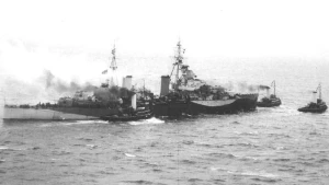
Hms Spartan Wreck
| Field | Value |
|---|---|
| Wreck Category | distributed remains of wreck |
|
Hms spartan Wreck Location Marine Coordinates (DMM) |
41 26.02 N,12 41.02 E |
| Latitude, Longitude Decimal Degrees |
|
| Water Depth | 12 m |
| Water Level Effect | always under water/submerged |
| Vertical Datum | Mean Low Water Springs |
| Name | HMS SPARTAN |
| Type | light cruiser |
| Flag | GB |
| Length | 154.2 m |
| Width | 15.5 m |
| Draught | 4.3 |
| Tonnage | 5450 |
| Tonnage Type | displacement |
| Conspic Visual | not visually conspicuous |
| Conspic Radar | not radar conspicuous |
| Date Sunk | Jan 29, 1944 |
| Original Detection Year | 1944 |
| Last Detection Year | 2021 |
| Original Source | other |
| Last Amended Date | Apr 15, 2021 |
Circumstances of loss
BUILT IN 1942 BY VICKERS ARMSTRONG, BARROW. WAS SUNK BY HS 293A GLIDER BOMB IN ANZIO BAY, OFF NETTUNO BEACH-HEAD HWILE SUPPORTING THE ADVANCE OF THE AMERICAN 5TH ARMY. THE WEATHER HAD BEEN EXTREMELY ROUGH & THE LANDING OF REINFORCEMENTS & SUPPLIES FOR THE ARMY HAD BEEN HELD UP FOR SOME DAYS. THIS PRODUCED A SERIOUS SITUATION FOR THE MILITARY ON SHORE & SUPPORT BY THE GUNS OF THE FLEET WAS ESSENTIAL AS THE GERMANS WERE KNOWN TO BE MOUNTING AN OFFENSIVE. SHE CAUGHT FIRE & BLAZED FOR SOME HOURS BUT SANK BEFORE NIGHTFALL. DESTROYERS TOOK OFF A LARGE PROPORTION OF HER COMPLEMENT OF BETWEEN 450 & 500. FIVE OFFICERS & 59 RATINGS WERE KILLED. (DODS, SHIPS OF THE ROYAL NAVY, COLLEGE & SLWW2).
WRECK MAP LOADING ...
41 26.02 N,12 41.02 E
Hms Spartan on Wreck Map
Hms Spartan Wreck on Google Map
Nearby Wrecks:
- Other Wreck 63369 1778.8 M
- Hms Inglefield Wreck 3563.3 M
- Gabriella Wreck 3807.3 M
- James Russell Lovell Wreck 4018.4 M
- Costantino Ii Wreck 4031.4 M
- Elihu Yale Wreck 4571.8 M
- Other Wreck 1379 5117.1 M
- Other Wreck 64029 7491.8 M
- Other Wreck 64032 17478.8 M
- Hms Janus Wreck 17865.1 M